Dredging Catahoula Lake
Catahoula Lake is filling up with silt. The small lake in St. Martin Parish is now so shallow in places that grassy mounds can be seen poking up through the surface of the water throughout the year, and it’s hard to get a boat across the belly of the lake without your motor grinding mud. The good news is that a parish public works project aimed at restoring depth to the lake is currently underway.
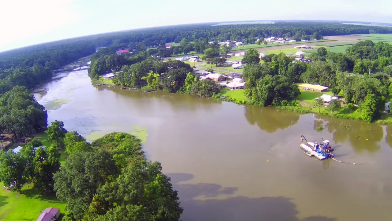
Dredge boat in Catahoula Lake
A hundred years ago, Catahoula Lake was its own little lake in the larger labyrinth of the Atchafalaya Basin—fed by small bayous that came in from the east, and one long coulée that came in from the west, but otherwise relatively isolated. With its almost-straight-down banks and seemingly bottomless depths, the lake stood out from its surroundings. Bodies of water in southern Louisiana are typically shallow, muddy depressions. Catahoula Lake was two miles long, reputed, at one time, to be a hundred feet deep, and with water the transparency of crystal. And the colorful legend that became attached to its creation only added to its mystique.
One day, the story goes, the earth cracked open without warning, swallowing an entire encampment in a single gulp, the yawning canyon filling at once with subterranean water. Cata-Oulou, as it was originally called, has long been regarded as a sacred body of water. Before the arrival of Europeans in the area, it was home to the Chitimacha, and recently excavated pottery shards attest to the presence of human inhabitants there for at least the last twelve hundred years. Seasonal flooding from the sprawling and unpredictable Atchafalaya River, however, prevented the construction of more permanent dwellings and farmland until the West Atchafalaya Protection Levee was built in the early 1930s, walling off Catahoula Lake from the flood-prone Atchafalaya Basin and carving out a tight-knit community along the peaceful lake.
Catahoula Lake
The construction of the levee allowed French-speaking fishermen and farmers, lured by fertile farmland and the natural resources of the nearby Atchafalaya, to settle near Catahoula Lake. But it came at a price. The narrow lake was no longer an isolated body of water. It was just another link in the long network of waterways draining parts of Texas, Oklahoma, Arkansas and northern Louisiana, a conduit for massive volumes of water going from the Red River Valley and the Atchafalaya River Basin into the Gulf of Mexico. With water comes dirt and silt, mostly run-off from farmland upstream, and as a result of all this wash-through, Catahoula Lake has been slowly silting up.
While it retains much of its original splendor, especially the muscadine-draped bayous at its southern end, Catahoula Lake, described ninety years ago as “one of the most beautiful and alluring resorts in Louisiana, and one at which the visitor marvels in the natural glory of these surroundings,” has undergone dramatic changes from its glory days. Once prized for its abundance of blue crabs, the lake has not seen crabs for at least fifteen years. The water isn’t as clear as it used to be. And when you’re boating through the belly of the lake, through what may look like plenty of water, there’s a lot less water than you think there is. The banks of the lake are closer than they appear, just barely disappearing underwater . . . and they’re getting closer to the middle every year.
Catahoula Lake
The dynamics of silting have to do with the velocity of water. When water flows down from the north, it slows suddenly as it arrives at the belly of this otherwise long and narrow lake, and this slowing causes silt to settle there. In 2019, the parish public works department put out proposals to dredge the lake, with the goal of improving navigation and optimizing flood control, and also to give the little lake a long overdue facelift.
The problem with dredging a body of water is that now you have to figure out what to do with all the stuff you dredge up. You have to find a place to send that clay and mud and muck. The parish sought out farmland in the vicinity of the lake that could be used to deposit the dredge spoils, eventually entering into a contract with my father, Jackie Theriot, to convert half of his sugar cane field into a containment area, about a mile from the proposed dredging. The first stage of the project, completed in spring of 2022, was the construction of a giant containment dike around thirty-seven acres of farmland. The containment area is massive—2600 feet by 550 feet—and is surrounded by a seven-foot-tall earthen levee created for this purpose.
Containment area for dredge spoil
The actual dredging of the lake bottom began at the end of June. A barge with a hydraulic dredging system is slowly making its way back and forth across the belly of the lake. Rotating cutter heads mobilize the sediment in a precision manner, then vacuum it up and pump it through a mile-long underwater pipeline that empties into the containment area. As the dredge spoil accumulates and settles, water will flow back into the lake via a drainage system, and soil will stay behind.
Around-the-clock dredging between the bridge and the north end of the lake is expected to continue for another three or four weeks, at which point the pipeline will be removed. Once the dredge spoil settles and dries—this phase is estimated to take about a year—the containment area will be laser-leveled and returned to farmland.
Drone photograph of Catahoula Lake facing south


